Sunday, February 24, 2013

Florida to California

Arrived in Hollister, CA yesterday, to deliver N40HB to Hugh.  It was a beautiful flight, full of great sights, fairly good weather except for headwinds, and almost perfect performance from the Phoenix.  Why not perfect?  Had a flat tire in Boulder City when I stopped for fuel.  So it became an overnight stop to fix the flat, and then tackle the Sierra Mountains in 50kt winds aloft.
I'll post a trip report as soon as possible.  In the meantime, a few photos:
 The green rolling hills of Hollister are a different shade of green than Florida, due to the yellow flowers mixed with the grass.

 Hugh

Hollister airport

Hugh's home and landing strip

Tuesday, February 19, 2013

Florida to California

I'm off to Hollister California tomorrow (Feb 20) to deliver a new Phoenix to Hugh.  Based on current wind information, the route will be this way on Skyvector:
http://skyvector.com/?ll=36.78652159322156,-118.09739685284992&chart=301&zoom=2&plan=V.K7.MLB:A.K7.KTLH:A.K4.9X1:A.K4.KLBB:A.K2.KSAF:A.K2.KCVH

Friday, February 15, 2013

Bogota Flight Leg 5: Cartagena to Bogota

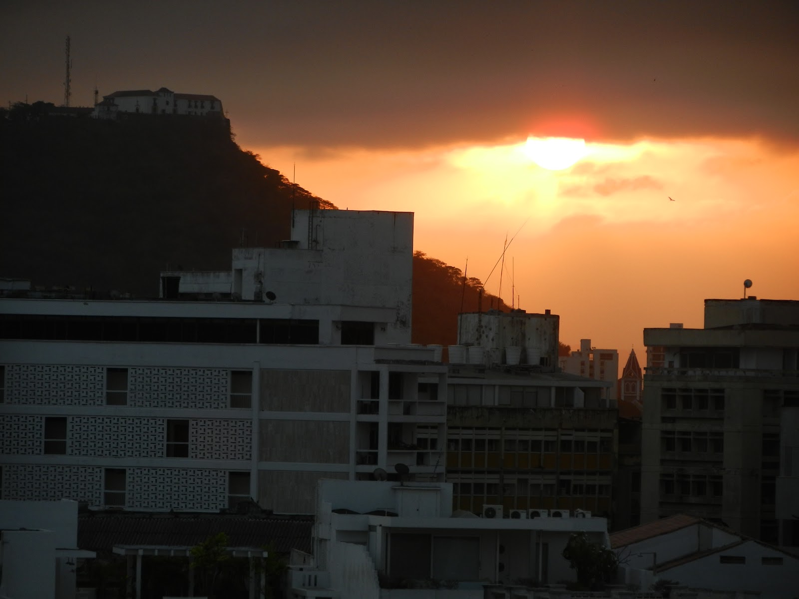
 Up at sunrise to get an early start due to predicted cloud buildups on our route later in the day.

 The crew at Cartagena was friendly, courteous, and helpful.  Matter of fact, that is what we found at every stop on the way.

 Departing SKCG.


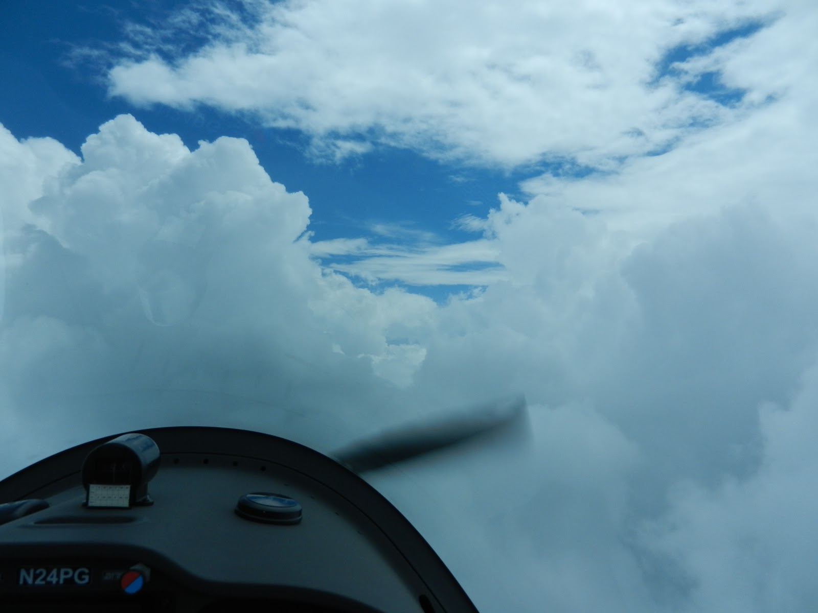
Andres took one look at the towering clouds ahead and asked what do we do now?  My response: Climb!


We finally topped out at 13,500'.  There were mountains in those clouds as high as 12,000'.  The little Phoenix U2 Spyplane ate up the sky!

 Then the clouds opened up allowing an easy descent to Bogota.  Perfect!

 Approach to SKGY, Chia Airport, at 8000'msl.


The police must ok every take off and landing.


Mauricio was one of a dozen friends who had to try on the Phoenix.  Mauricio is working on the software for a similar program to Foreflight for Columbian airspace.

 Phoenix shares the hangar with Andres' other plane, a Navajo.

This trip of a lifetime for me was made possible by my new friend Andres Lisocki.  Thanks Andres!!!
Trip stats:  360nm  3.5 hours  103kts average speed
Total trip length:  2301nm
Total time: 20 hours
You can view the flight paths on my favorite flight planning website, Skyvector.  Click on the link below to view the flight route on Skyvector.  

Sights of Cartagena

 After securing the Phoenix we had time to head for Andres' apartment and then take a tour of the city.  Here is the view off of the front porch.

 View from the rear balcony.


Stats:
37-24-35
OK, this lady really was in Cartagena.  Nobody ever comments on this blog.  Is anyone out there?

Flight to Bogota Leg 4: San Jose to Cartagena


Almost ready to leave San Jose, Costa Rica.  Hey Andres, wait for me!

Leaving San Jose.


Crossing the mountains in Costa Rica.


 Panama Canal


Panama City, Panama

 Andres' private island about 20 miles offshore from Cartagena.


Approaching the new skyscrapers of Cartagena with the older area of the city on the far left point.


Cartagena hangar space.
Trip stats:
550nm  
4.5 hours
10,000' cruise altitude


Flight to Bogota Leg 3: Belize to Costa Rica


Leaving Belize, the sky was an almost solid overcast.


We had to climb around the clouds to get on top.


 Endless reefs to scuba, snorkel and sail around.
Flying above the  Honduran coastline.


 San Cristobal volcano in Nicaragua

 Momotombo volcano in Nicaragua

 Apoyeque pyroclastic shield volcano

Andres gets ready for 2 hours of paperwork at Aeropuerto Tobias Bolanos in Costa Rica, but we are glad to be here!
Route stats:  4.7hrs  581nm 124kts average speed  11,000' cruise altitude

Flight to Bogota leg 2: Key West to Belize


Leaving Key West and land behind.

Are we ready for this?


Water and clouds


Andres follows the course on his ifr chart


Coast of Cozumel, and we turn south to parallel the coast


Approach to land in Belize

The clearing in paperwork begins.  Rudy did a great job of expediting the process, but he shouldn't be leaning on the wing like that.
Leg stats:  581nm  4.9hrs  119kts average speed  12,000' cruising altitude

Wednesday, February 13, 2013

Trip to Bogota, Columbia first leg: Melbourne to Key West

After a myriad of details, Andres and I finally left Melbourne in the afternoon, headed to Key West.  It was an easy warm up for the long days ahead.


Typical cruise speed, 103kts indicated, 121kts true at 9000'.


Typical pilot equipment: phone with music and mini iPad with Foreflight.  What has flying come to?


Circling to land at Key West.  After we landed, the lineman said "Hey that is a Phoenix, one of those just landed here a couple of days ago".  That's right, Russ and Lynn were just here!
Andres and I cleaned up at the nearby motel and then went out to a nice fish restaurant which would have been better without the karaoke music.  We sat as far from the microphone as possible.  After a good night's sleep, we were off on the real leg of the journey; Belize via Cozumel.  Stay tuned!